Menu

Cho Oyu Expedition

45 Days
  • Hotel, Lodge, Tea House
  • Private Car/Bus
  • Difficult
  • Full board while on trekking
  • 8201m
  • Expedition
  • 10-16 Pax
  • Kathmandu, Nepal

Overview

Introduction

Cho Oyu is the sixth highest peak of the world (8201m/26906ft). Cho Oyu in Tibetan is “Turquoise God’ which means the turquoise color of the peak in the afternoon sun from the Tibet side of the mountain. But in Nepal it is known as Qowowuyag by the Sherpas. The mountain lies in the Himalayas and is 20 km west of Mount Everest, at the border between China and Nepal. Though the expedition attempt was made by Eric Shipton in 1952, an Austrian Herbert Tichy made the first successful ascent of Cho Oyu in 1954 with fellow Austrians Sepp Jochler and Helmut Heuberger.

Outline Itinerary

Day 1: Arrival in Kathmandu and transfer to the hotel
Day 02-03: Visa document application, preparation, and briefing in ministry
Day 4: Drive from Kathmandu to Syabrubesi, 1460m
Day 5: Drive from Syabrubesi to the Kerung border at 2000m. Immigration formalities for crossing the border and driving to Kerung height (3200 m)
Day 6: Drive from Kerung to Tingri (4340 m)
Day 7: Rest day at Tingri for acclimatization
Day 8: Drive Tingri to the Chinese base camp
Day 09-11: Rest and preparation day in the Chinese base camp
Day 12: Trek from the Chinese base camp to Middle Camp (5300 m)
Day 13: Trek from Middle Camp to Advance Base Camp (5700 m)
Day 14–40: Climbing Period for MT. Cho Oyo, 8201m
Day 41: Trek to Middle Camp and drive to Tingri
Day 42: Drive from Tingri to the Kerung border.
Day 43: Immigration formalities on the Chinese side, then drive to Kathmandu. LEAVE TIBET
Day 44: Rest and shopping day in Kathmandu
Day 45: Expedition ends, farewell, and departure

Trip Highlights

  • Also known as TIchy route, this is the Tibet side normal climbing route used for commercial expedition.
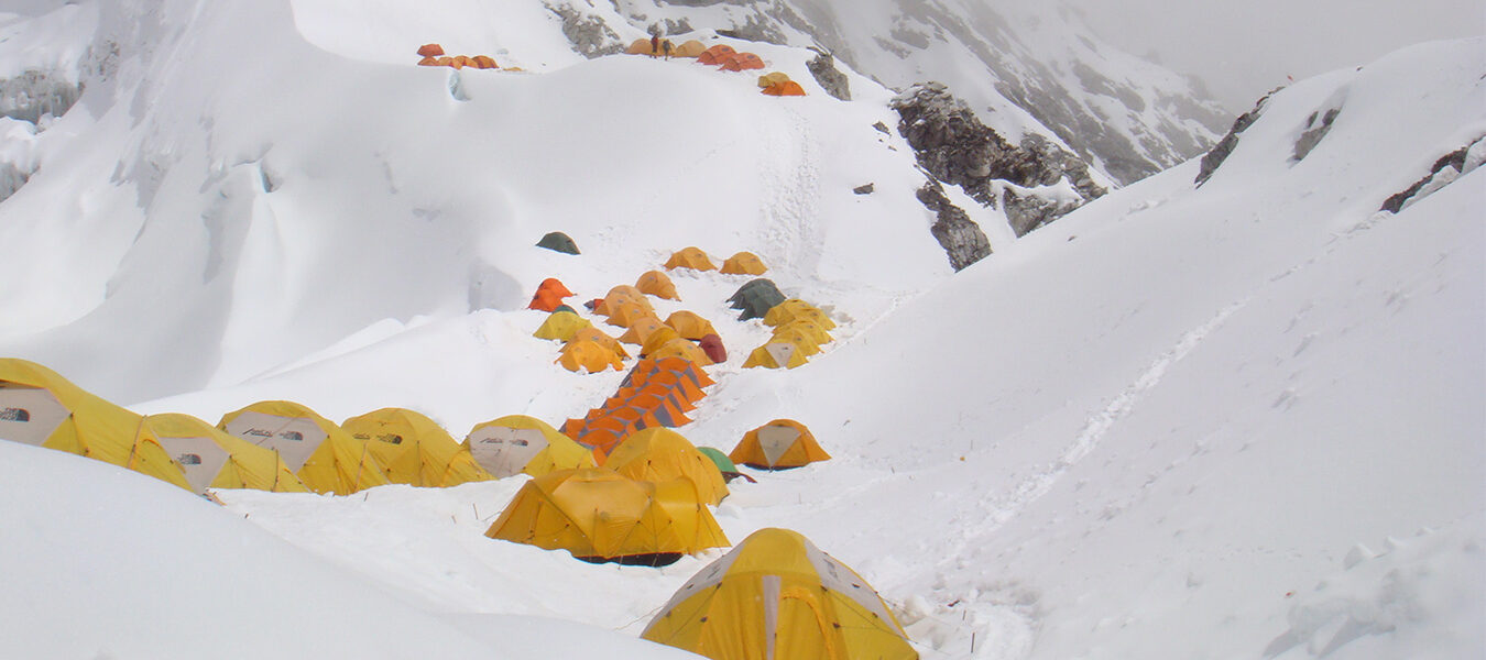
  • Camp 1 - 6,400m: It takes about 5-8 hours of steep climbed to reach camp 1 from base camp. From here, the route follows steep climbing, which improves as height is gained. Camp 1 is located on a broad shoulder of snow, which leads up to a ridge above the camp.
  • Camp 2 - 7,000m: Follow snow ridge to series of ice cliffs and involves steep 50m ice wall at 6600m. Though straight forward it is hardest climbing in the route. Above the ice cliffs, there are several crevasses giving access to Camp 2 at 7,000m.
  • Camp 3 - 7,400m: it takes around 4 hr to reach camp 3. it is located beneath a rock band that cuts off snow slopes of upper basin. We see beautiful Nangpa Gosum peak and Tibetan plateau in north side.
  • Summit Day: Altitude is challenging on the summit day. We start at mid night. We follow snow and rock ledge leading to short rock band. Once on the summit, magnificent vista of plateau, and Mountain View of Ama Dablam, Lhotse, Nuptse, Menlugtse, Gyachung Kang and Gaurisankar are seen. We reach the summit five to eight hours after leaving Camp 3. For the descent the same route will be followed, with nights spent at Camp 3 and Camp 1.

Itinerary

We welcome and receive you in Tribhuwan International Airport, Kathmandu and transfer you to the Hotel for overnight stay. At evening we will host welcome dinner program in typical Nepali Restaurant. Hotel (BD)

This day we are busy for briefing about expedition, documentation, visa application, last minute shopping and preparation for departure to expedition. We’ll also introduce to our Nepali crew coming with you for expedition. Hotel. BLD

After morning breakfast we drive out along the north-western hills of Kathmandu. Enjoy the Himlayan views and mountainous lifestyle through the terraced fields and rustic villages. Take Lunch at the Trishuli Bazar before continuing further to Dhunche. From Dhunche, we descent down to Syabrubesi. Hotel (B,L,D)

Early morning drive from Syaprubesi to Kerung border. After finishing immigration formalities for crossing the border it is 2 hours jeep drive till Kerung Height. We stay overnight at hotel. BLD

After morning breakfast we drive from Krung to Tingri about three hours.

Today is the rest day for acclimatization in order to cope our body with heights. Walk in the surrounding hills, hang out around. Overnight at hotel, BLD

Overnight at tented camp BLD

Overnight at tented camp BLD

Overnight at tented camp BLD

Overnight at tented camp BLD

From this point on, it’s not really possible to detail a climbing plan, because the pace will depend upon the leader and the particular team.

We set about acclimatizing and learning skills needed for climbing the mountain, such as how to use the oxygen bottles and radios. We will also sort out our equipment and clothing needed for the mountain, setting aside the food we want for the upper camps (as this will be placed there for us ahead of time by the Sherpa).

From the base camp we climb along the glacier toward the mountain and Camp 1. Because of the high altitude, this first trip up the Gyabrag Glacier and onto the mountain itself is for familiarizing participants with climbing and their equipment. It provides an excellent opportunity to view the route that will be taken and assess the mountain conditions.

Throughout the climb, the leader will use a method that adjusts team members to the ever-increasing altitudes. This will be achieved by "climbing high and sleeping low," until each person feels suitably well-adjusted to make the next move up to a higher camp. At each camp, the team will climb high but then return to the lower camp to sleep.

Summit Day

Summit Day begins early, as it takes several hours to make breakfast, hydrate properly, and fully prepare equipment before embarking. The camp faces west, so there is plenty of time for preparations before we depart as the sun rises. Once on our way, easily navigable snow and rock ledges lead through the short rock band above the camp. Gradually the angle of the slope relents until we emerge onto the broad windswept back of the mountain. Now it is only a matter of putting one foot in front of the other to slowly gain the towering distant summit of Cho Oyu, overshadowed only by Mt. Everest. The magnificent vista surrounding us as we cross the vast summit plateau toward the peak includes Ama Dablam, Lhotse, Nuptse, Menlugtse, Gyachung Kang and Gaurisankar, as well as the peaks of the Khumbu Himal. We reach the summit five to eight hours after leaving Camp 3. For the descent the same route will be followed, with nights spent at Camp 3 and Camp 1.

If we are successful in completing the climb ahead of schedule, we will leave the base early and head back to Kathmandu. However, past experience has shown that we will need all of the allotted days unless mountain conditions and the acclimatization process go exceptionally well.

Trek to Middle camp and drive to Tingri

Drive from Tingri to Kerung border.

Immigration formalities in China side. Then drive to Kathmandu. Leave Tibet

Today you’ll have free in Kathmandu. You can have sightseeing in the cultural heritage inside Kathmandu, buy souvenirs and thankas to take back home or anything as the day is free and easy. Overnight at hotel (B)

We transfer you to the airport for final departure 3 hours before flight schedule. Farewell and departure.

Note:
Due to the Nepal-Tibet border closure from Zhangmu due to 2015 earthquake, the expedition logistic procedure has been shifted to Kerung border at Rasuwagadi.

The above itinerary is a guideline and standard suggested pattern chosen by majority of our customers. Your final itinerary will be customized according to your available time and requirements. The final itinerary duration and schedule may be reduced or extended depending on your time, budget, your fitness, class of service or any other preferences. The quote will be provided for you initial requirements and can be adjusted with mutual agreement should you require modifying these requirements.