
-
Hotel, Lodge, Tea House
-
Private Car/Bus
-
Difficult
-
Full board while on trekking
-
8201m
-
Expedition
-
10-16 Pax
-
Kathmandu, Nepal
Overview
Introduction
Cho Oyu is the sixth highest peak of the world (8201m/26906ft). Cho Oyu in Tibetan is “Turquoise God’ which means the turquoise color of the peak in the afternoon sun from the Tibet side of the mountain. But in Nepal it is known as Qowowuyag by the Sherpas. The mountain lies in the Himalayas and is 20 km west of Mount Everest, at the border between China and Nepal. Though the expedition attempt was made by Eric Shipton in 1952, an Austrian Herbert Tichy made the first successful ascent of Cho Oyu in 1954 with fellow Austrians Sepp Jochler and Helmut Heuberger.
Outline Itinerary
Day 1: Arrival in Kathmandu and transfer to the hotel
Day 02-03: Visa document application, preparation, and briefing in ministry
Day 4: Drive from Kathmandu to Syabrubesi, 1460m
Day 5: Drive from Syabrubesi to the Kerung border at 2000m. Immigration formalities for crossing the border and driving to Kerung height (3200 m)
Day 6: Drive from Kerung to Tingri (4340 m)
Day 7: Rest day at Tingri for acclimatization
Day 8: Drive Tingri to the Chinese base camp
Day 09-11: Rest and preparation day in the Chinese base camp
Day 12: Trek from the Chinese base camp to Middle Camp (5300 m)
Day 13: Trek from Middle Camp to Advance Base Camp (5700 m)
Day 14–40: Climbing Period for MT. Cho Oyo, 8201m
Day 41: Trek to Middle Camp and drive to Tingri
Day 42: Drive from Tingri to the Kerung border.
Day 43: Immigration formalities on the Chinese side, then drive to Kathmandu. LEAVE TIBET
Day 44: Rest and shopping day in Kathmandu
Day 45: Expedition ends, farewell, and departure
Trip Highlights
- Also known as TIchy route, this is the Tibet side normal climbing route used for commercial expedition.
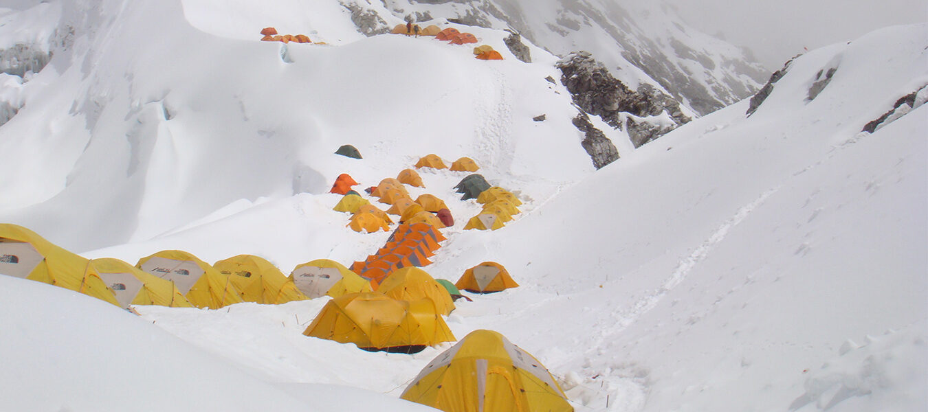
- Camp 1 - 6,400m: It takes about 5-8 hours of steep climbed to reach camp 1 from base camp. From here, the route follows steep climbing, which improves as height is gained. Camp 1 is located on a broad shoulder of snow, which leads up to a ridge above the camp.
- Camp 2 - 7,000m: Follow snow ridge to series of ice cliffs and involves steep 50m ice wall at 6600m. Though straight forward it is hardest climbing in the route. Above the ice cliffs, there are several crevasses giving access to Camp 2 at 7,000m.
- Camp 3 - 7,400m: it takes around 4 hr to reach camp 3. it is located beneath a rock band that cuts off snow slopes of upper basin. We see beautiful Nangpa Gosum peak and Tibetan plateau in north side.
- Summit Day: Altitude is challenging on the summit day. We start at mid night. We follow snow and rock ledge leading to short rock band. Once on the summit, magnificent vista of plateau, and Mountain View of Ama Dablam, Lhotse, Nuptse, Menlugtse, Gyachung Kang and Gaurisankar are seen. We reach the summit five to eight hours after leaving Camp 3. For the descent the same route will be followed, with nights spent at Camp 3 and Camp 1.