
-
12 Pax
-
supper Difficult
-
Private Car/Bus
-
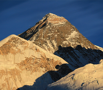
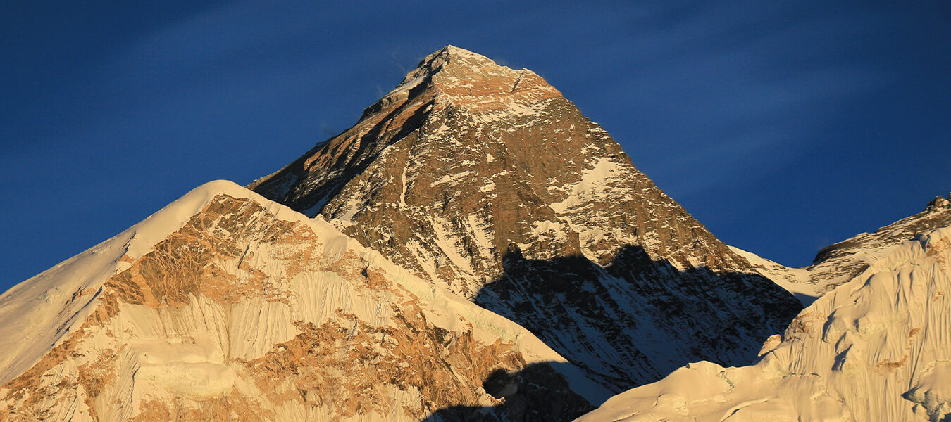
8848 m
-
Hotel, Lodge, Tea House and Tent
-
Full board while on Expedition as itinerary.
Overview
Introduction
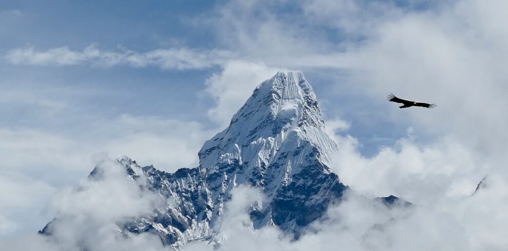
The Tibetan name for Mount Everest is “Chomolangma” which means “Saint Mother”. It has been in common use by Tibetans for centuries (BEFORE 1733 A.D). The height of Everest is 8848m. It was after the years and years of calculation and was announced by Great Trigonometric Survey of India in 1856.
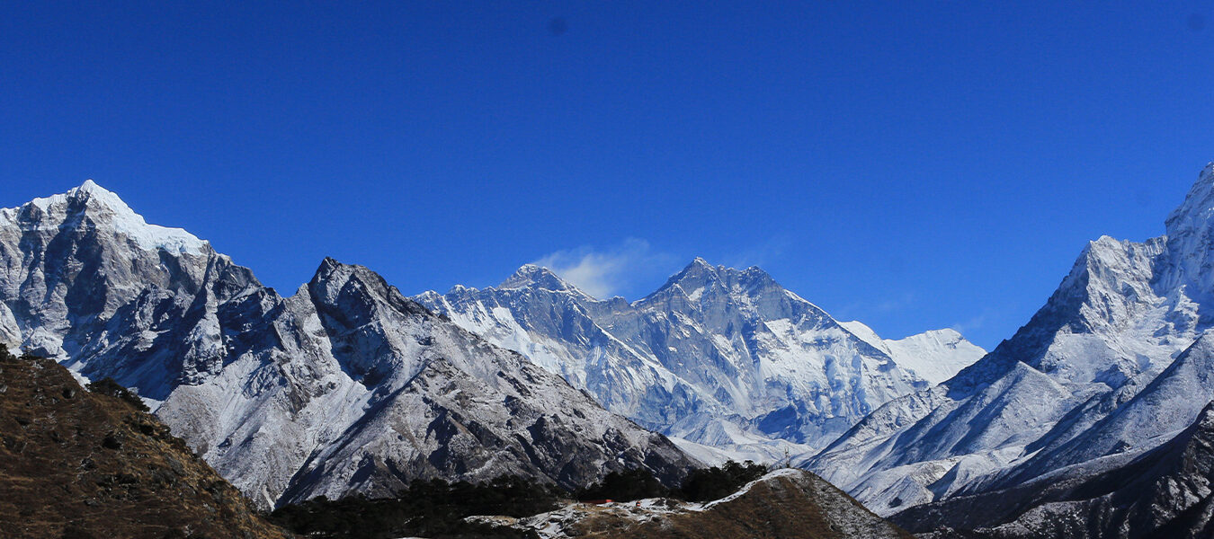
This peak was previously known as Peak XV to the western world. Then In 1865, Everest was given its official English name by Andrew wough. He was the British surveyor General of India. He recommended this name after his ancestor former chief, Sir George Everest. Andrew was send to Nepal by Sir George Everest for study of the peak. Only in the early 1960s, the Nepalese government gave Mount Everest the official name “Sagarmatha” meaning top of the world. There are 15 recognized routes for climbing Mt. Everest.
Every Year in spring and autumn the Mt. Everest Expedition could be scheduled from its South Face that is from Nepal. In autumn, expedition usually stars since last week of August and complete at around end of October. In this period the temperature toward the expedition area is changing from hot to cold. So, the climber has to face the critical situation for acclimatization for approaching to summit.
However in spring, the temperature to the Everest climbing area is getting from cold to hot which is more convenient for approaching to summit after sufficient acclimatization and practice in various camps. Start at the beginning of April and end at the beginning of June is the best recommended period for Everest Expedition in spring.
Thus, our recommendation for Everest summit dreamer is to choose spring than autumn. However, we are ready to organize this expedition in spring, autumn. Nepali Government authorities also allows climber to climb Everest in summer and winter too.
Outline Itinerary
02 APRIL, DAY 01: ARRIVAL IN KATHMANDU TRANSFER HOTEL
03-04 APRIL, DAY 02-03: Document application, briefing, and preparation
05 APRIL, DAY 04: Flight from Kathmandu to Lukla Airport and trek till Phakding
06 APRIL, DAY 05: Trek from Phakding to Namchebazar (3440 m)
07 APRIL, DAY 06: REST DAY FOR ACCLIMATIZATION IN NAMCHE
08 APRIL, DAY 07: Trek to Tengboche
09 APRIL, DAY 08: Trek to Dingboche
10 APRIL, DAY 09: Trek to Lobuche
11 APRIL, DAY 10: REST DAY FOR ACCLIMATIZATION IN LOBUCHE
12 APRIL, DAY 11: Trek to Gorakshep
13 APRIL, DAY 12: Trek to Everest Base Camp
14 APRIL-29 MAY, DAY 13-58: 46 DAYS FOR CONQUERING THE SUMMIT OF MOUNT EVEREST 8848M
30 MAY, DAY 59: Trek down from base camp to Dingboche via Lobuche 31 MAY, DAY 60: Trek to
Tengboche
01 JUNE, DAY 61: Trek to Namche Bazar
02 JUNE, DAY 62: Trek to Lukhla
03 JUNE, DAY 63: Fly Back to Kathmandu
04 JUNE, DAY 64: Rest day at Kathmandu
05 JUNE, DAY 65: EXPEDITION ENDS, FAREWELL, AND DEPARTURE
Trip Highlights
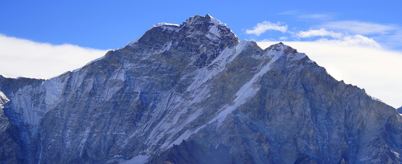
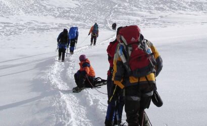
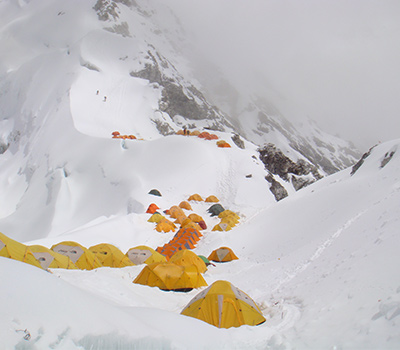
- It was the same route used by Edmund Hillary and Tenzing Norgay Sherpa in 1953. It takes 8-9 days to reach Base Camp at 5,334 m. Climbers spent days for acclimatization in base camp whereas Sherpa set up ropes and ladder in khumbu icefall which is most dangerous section of the route because of crevasses and changing block of ice. Above the icefall is Camp I at 5,943m.
- From Camp I: climbers make their way up to Advanced Base Camp (ABC) which is established at 6,400 m. The Western part is a flat, glacier valley, and number of crevasses is present in the center which prevents direct access to the upper part of Everest. So, climbers need to pass by the base of Mount Nuptse. Near the base of Nuptse, Western Cwm or "Valley of Silence". The topography of the area generally cuts off wind from the climbing route making the place unbearably hot for climbers.
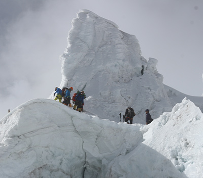
- From ABC: Climbers ascents the Lhotse Face on fixed rope up to Camp III, located on a small edge at 7162m. From there, it is another 800 mtrs to camp IV at 8000m. From Camp III to Camp IV, climbers now face two challenges. 1. The Geneva Spur: It is the blocks of rock named by Swiss Expedition Team in 1952. 2. The Yellow Band: It is a section of inter layered marble, phyllite and semi schist which requires about 100mtrs of rope to cross it.
- After Camp IV: Climbers then enter the death zone. Climbers generally have maximum 2-3 days that they can bear at this height. Clear weather and low winds are factors in deciding to make a summit attempt. If weather does not favor, climbers are forced to return back.
- From Camp IV: climbers can begins their summit push around midnight as they have only 10 to 12 hours for making rest of the heights. Climbers first reach “THE BALCONY” at 8,400m, it is a small platform where they can rest and watch at peaks in early light of dawn. While walking up the ridge, climbers face series of striking rock steps. Climbers then follow the knife-edge southeast ridge which is known as “CORNICE TRAVERSE”. This is the most exposed section of climb. If miss-step then the climbers falls about 2,400m down. At the end of CORNICE TRAVERSE at 8760 m, there is an 12m rock wall called “HILLARY STEP”. After crossing the “HILLARY STEP”, it is an easy climb to the “top of the world”. After the summit, Climbers have to descent to Camp IV before darkness because afternoon weather becomes serious problem on the top and also supplement oxygen may run out. So, climber spent less than a half-hour on the “top of the world”.
Write a Review